Land of Memories
The Photographs of Mark Adams Through an Archaeologist’s Lens
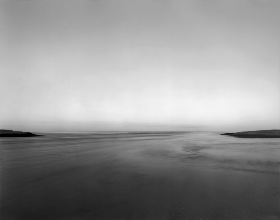
Mark Adams 30.4.1988. Waitaki Awa Mouth. Korotuaheka. Te Waipounamu 1988. Digital scan from 8×10 inch Kodak Tmax 400 film negative
As an archaeologist specialising in Māori rock art heritage I have been taken by the intertwining of three modern recognitions in international rock art and archaeological research. Firstly, landscapes are not objectively viewed and fixed physical environments – rather they are mental constructs that exist in our minds and are shaped by our cultural understandings, personal experiences, beliefs and changing social contexts. Secondly, fixed in place where the ancestors made it, the location of a piece of rock art in a landscape is a critical part of its meaning over and above its motif subject. And, thirdly, still fixed in place, rock art is intergenerational; it can last tens of thousands of years.
Over that time its environmental and social context changes, with multiple audiences each bringing vastly different insights into their interpretation. As such, what rock art ‘means’ is not fixed or constrained to the intent of the original artist but shifts with lenses the different audiences bring to their viewing. These three lines of thought are what I find myself arriving at when revisiting the landscape photography of Mark Adams.
I first encountered Mark’s photographic landscapes over thirty years ago through his 1993 publication, Land of Memories. The subtitle has stuck in mind ever since – ‘Whenua i maharatia, haehae ngā tākata / Land of memories, scarred by people’. The context then was within the pursuit of Te Kerēme, Kāi Tahu’s land claim. To my reading, as my father wrote in the book’s foreword, these were images that shaped visual memory around Harry Evison’s historical text calling out tribal memory of place. That was early in my heritage career. Since then I have regularly been drawn back into the volume as my own experience of those wāhi tupuna, those ancestral places, has grown. My memories of places have become increasingly shaped by archaeological curiosity, and that applies to my experience of Mark’s incredible landscape photographs.
About fifteen years ago I was fortunate to meet up with long-time Taupō archaeologist Perry Fletcher, who had taken a particular interest in Central North Island rock art. Perry introduced me to a number of sites which, with the support of mana whenua, I was privileged to study for my PhD. One wāhi tupuna that I never got to is a koru engraved in a rock that sits a little offshore at the southern end of Lake Taupō. It has long been known in archaeology, having been illustrated in both the 1971 and 1981 editions of Prehistoric Rock Art of New Zealand by Michael Trotter and Beverley McCulloch. Perry described the rock to me as being near a hot spring and associated with a tupuna who came to grief there. So does the engraved spiral mark the hot spring? Does it remember the events surrounding the tupuna? Or was it made for completely different reasons? The pursuit of meaning has traditionally consumed rock art researchers, but whatever the explanation, fixed in place, the geography surrounding the rock is part of the context in which its significance can be explored.
Years after I had first heard of the engraving on the Taupō lakeshore, and doing post-doctoral research collating information on rock art across Te Ika a Maui, I still had not seen the koru. I asked Perry about the possibility of a visit with Ngāti Tūwharetoa, and he advised that since the lake levels have been controlled by a hydro dam the koru was seldom exposed. This frustrates him as he once thought he saw another koru on rock a bit further offshore but never had an opportunity to get out there to confirm it. Unfolding like something from a Dirk Gently detective novel with the “interconnectedness of all things”, it was soon after talking with Perry that Mark generously shared his photographs of North Island rock art with the research project. Among them was a multi-scalar landscape of Taupō-nui-a-Tia capturing the koru in the foreground, midfield another rock slightly further offshore, then the lake stretching behind it to a distant shore. Zooming in on a close-up of the rock just offshore, appreciable through the fortuitous lighting and calm lake that allowed Mark’s photograph, we see the second koru. How easily it could have been forgotten! A research grant allowing my work on North Island Māori rock art, Perry sharing his recollection of the second koru with me, planting a memory so that I looked out for it in the background of Mark’s photograph.
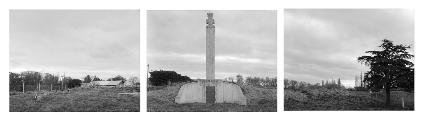
Mark Adams The Kaiapohia Monument 1988. Digital scan from 8×10 inch Kodak Tmax 400 film negative
And now it is known that there are two koru, what does that do for interpretations of meaning? Perhaps the explanations are not needed for the Ngāti Tūwharetoa kaitiaki, the guardians of that wāhi tupuna, but rather taking the time to ask the questions allows the different possibilities and ideas of landscape to be explored. As a rock art researcher, I also recognise an irony in this story. The history of most modern artistic engagement with Māori rock art is one of appropriation in which the motif is lifted, often from the archaeological record and reused in new media and contexts. Yet Mark’s photo of the Taupō koru is the other way around. His careful photography, making it memorable, captured archaeological detail helping give story back to place.
Nor is this a one off. Returning to Te Waipounamu a few years ago, I heard a kōrero of a prominent rock inland of my marae at Moeraki that was marked to denote the boundary of the Kemp Purchase. A couple of years ago a whanauka reintroduced me to a rock shelter in the Herbert Forest that I first visited when it was surrounded by gorse over twenty-five years ago. There was a mention that it might have been associated with that boundary marking, but the reference wasn’t at all clear. Our rūnaka has subsequently made a couple of visits up to that shelter, in which we see a tiki – a human figure – painted (not drawn) in kōkōwai with a dynamic stance and some form of headdress, perhaps feathers. It is a truly unique motif, with elements reminiscent of some figures in the North Island too, and being so close to our marae it has truly captured both my researcher and my parochial curiosity. On another rock art mission only last week, I revisited that site surrounded by the tall pines of the Herbert Forest and happened to photograph its entrance. Then, again the interconnectedness of all things – returning to the Land of Memories, I saw a cave depicted that I had paid little attention to before. The title of Moeraki Hill Cave and caption showed it to be the cave with the boundary marker, and a comparison of the detail captured in Mark’s photograph allows confirmation that it is indeed the rock shelter we visited. But beyond just identification, the absence of the pine forest in Mark’s historic capture provides me an opportunity to think of the place differently from the forested context of my own experience.
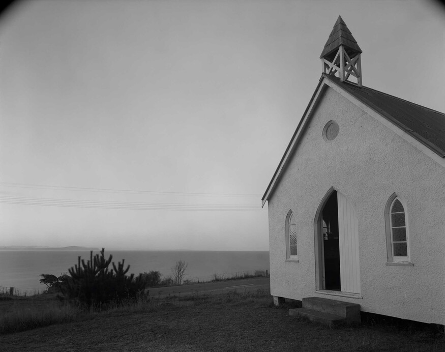
Mark Adams Matiaha Tiramorehu. Kotahitanga Church. Moeraki. North Otago. 1991. Digital scan from 10×8 inch Kodak Tmax 400 film negative
Many of those southern wāhi tupuna in Land of Memories are now places that I have my own experience of – Fiordland’s sounds; the famous Waitaki River Mouth, from which we recently dated a piece of archaeologically recovered coconut shell (which proved modern, dashing hopes of having something brought here by the first Polynesians); the Takiroa rock art site currently undergoing cultural reinvigoration by my rūnaka; Moeraki’s Kotahitanga Church, which we are actively conserving Mark’s photograph of the Kaiapohia Pā monument had long been my only image of that most famous of our Kāi Tahu pā. A recent serendipitous tipi haere sees my own direct experience added which now couples with insights of Tūhura Otago Museum collections to beckon a study of Kāi Tahu use of concrete cast whakairo. Without forgetting the Claim, it is no longer so front of mind now when revisiting those photographs. Te Kerēme remains an important chapter, but it is a broader history that I now connect with in the landscape photographs. At their very core my memories are part of my individual self. That is how I hold them. I talk of them, relate them to other people, compare them with those of others, and sometimes moderate my own in response. And so, my memories become part of something shared and collective, but typically still with my own individualistic bent. When I pause and absorb Mark’s photographs of our wāhi tupuna, I find myself entwining my memories of places with the stories he captured when he applied his lens to them. In some cases, these photos of landscapes bring forward my own memories, which mix, blend or critique with Mark’s perspective. Some of the photographed places I still have never been to but only heard of, so the photograph generates a completely new idea – a new visual memory of place. Others offer a fleeting point of reference that may be drawn up from the depths years later when discussing places and histories with other folk. And so, through fixed locations, shifting cultural context and viewings changing over time, I find myself hugely thankful for the significant contribution Mark’s photographs have made to my memory of tribal place and the landscapes in which I live.
Related
Exhibition
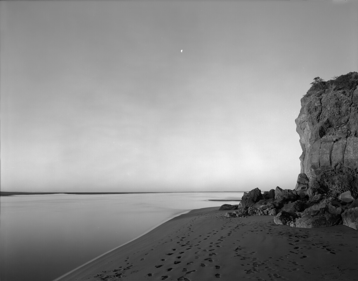
Mark Adams: A Survey | He Kohinga Whakaahua
7 March – 26 July 2026
A comprehensive survey spanning the artist's career.