Kā Kaupapa o te Wā
What’s On
Made in the Pacific: A Collection of Tāoga
A selection of Pacific tāoga from the Canterbury Museum in conversation with contemporary artworks that highlight the continued strength in culture and traditional art forms.
Mark Adams: A Survey | He Kohinga Whakaahua
A comprehensive survey spanning the artist's career.
Ana Iti: Ngahere Behind a Pile of Metal
An immersive installation considering the legacies of deforestation and significance of kauri trees.
E tuwhera ana te wharetoi i kā rā e 7 o te wiki, 10am - 5pm
Ka tuwhera ki te 9pm i kā pō Wenerei
Open 7 days, 10am - 5pm
Late night Wednesday until 9pm
Uruka utukore, ahokore utukore
Free entry, free wifi
Bulletin of the National Art Association of New Zealand
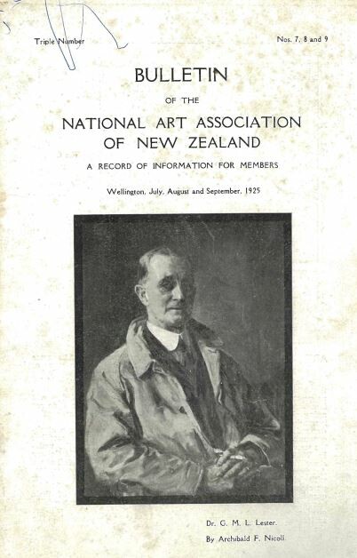
Bulletin of the NAANZ, issues 7, 8 and 9, July, August and September, 1925
Bulletin of the National Art Association of New Zealand

Bulletin of the NAANZ, issues 4, 5 and 6, April, May and June 1925
Bulletin of the National Art Association of New Zealand
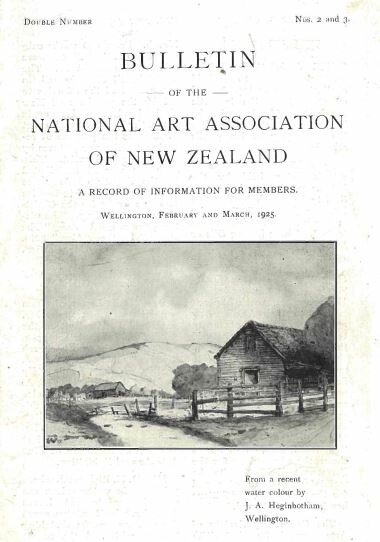
Bulletin of the NAANZ, issues 2 and 3, February and March 1925
Bulletin of the National Art Association of New Zealand
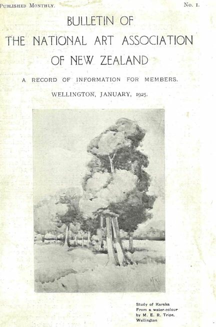
Bulletin of the NAANZ, issue 1, January 1925
Collection
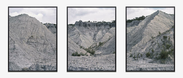
Natalie Robertson The Blue Slip (Barton's Gully), from Mangarara Stream
Natalie Robertson creates photographs and moving images that explore mātauranga Māori through a whakapapa lens. This triptych traces the ongoing loss of land through erosion caused by years of introduced forestry around Mangarara (Barton’s Gully), the upper catchment of the Waiapu River in Te Tairāwhiti Gisborne; it’s a region she has whakapapa links to and has visited regularly throughout her life. Parawhenuamea, the atua of alluvial waters, is a maker of land, carrying sediment loads to the ocean. However, colonial, industrial and economic drivers have intensified the changes to land and ocean in this area and led to extreme coastal erosion – a situation an Indigenous approach to environmental custodianship could have mitigated.
mātauranga Māori ~ Māori knowledge
whakapapa ~ genealogy, lineage, ancestry
atua ~ ancestor with continuing influence, god, deity
He Kapuka Oneone – A Handful of Soil (from August 2024)
Collection
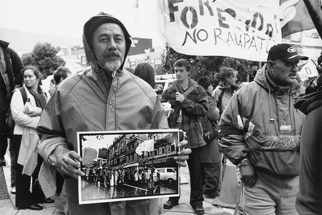
John Miller 2004 Foreshore and Seabed March, Cyril Chapman holding photograph of himself leading the 1975 Māori Land March in Wellington
In April 2004, a hīkoi left Te Tai Tokerau Northland in protest against proposed legislation to transfer ownership of the Aotearoa foreshore and seabed to the Crown. The hīkoi was joined by numerous supporters on the way south and arrived in Te Whanganui-a-Tara on 5 May 2004. The march was another example of the ongoing fight by Māori for tino rakatirataka over their whenua. Using the camera as a witness, Miller walks us backwards through history to our current moment, revealing iconic cultural shifts – and showing us how little has changed.
tino rakatirataka ~ self-determination, sovereignty, autonomy, self-government
whenua ~ land
Collection
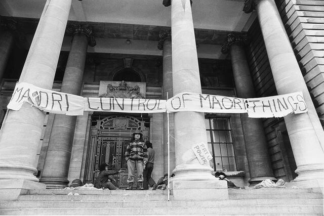
John Miller 1972 Ngā Tamatoa occupation at Parliament, including Tāme Iti
Over many decades John Miller’s ever-present lens has recorded the people who have had profound and long-term impacts on Māori land rights in Aotearoa. Tāme Iti (Ngāi Tūhoe) has appeared in many of his photographs, including in this powerful image of Ngā Tamatoa occupying parliament grounds in 1972 during a campaign for the teaching of te reo Māori in schools. A lifelong and committed activist, Iti appears again in Miller’s photos of Ngā Tamatoa protests at Waitangi in 1972, the 1975 Māori land march, the occupation of Taiarahia Hill in 1986 and many others.
Ngā Tamatoa – A Māori rights activist group formed in the 1970s.
Collection
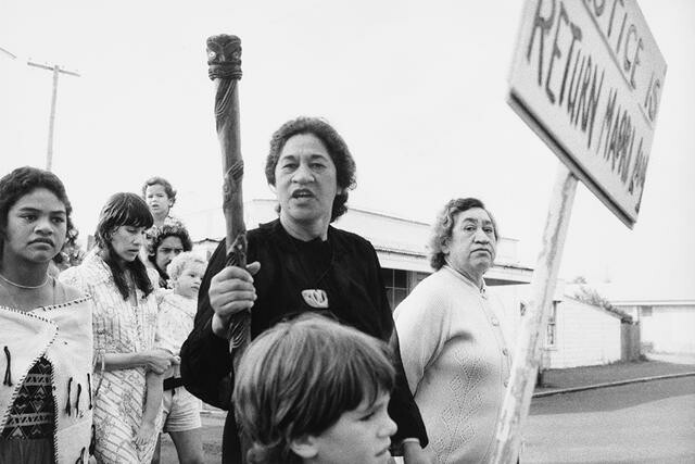
John Miller 1978 Raglan Golf Course Occupation, Eva Rickard
This photograph shows Tuaiwa (Eva) Rickard (Tainui, 1925–1997) and her sister Ripeka, her daughter Angeline and granddaughter Hineitimoana. Rickard is perhaps best known for leading the campaign for the return of Te Kōpua in Whāingaroa Raglan. Te Kōpua is Māori land that was claimed as a military airfield during World War II only to later become a golf course. Rickard opposed further extensions of the golf course over burial grounds. In 1978 on the day of the golf club’s annual tournament, Rickard invited tohunga and supporters to gather at Te Kōpua urupā for karakia, where she and sixteen others were arrested for trespass. By 1991, after many more years of negotiations, the land was finally returned to Māori ownership, and is now home to a community centre and a kōhanga reo.
tohunga ~ skilled person, priest, healer urupā ~ burial ground, cemetery karakia ~ incantation, ritual chant kōhanga reo ~ Māori language preschool
(He Kapuka Oneone – A Handful of Soil, 2025)