Art Over Nature Over Art
(Re)Imaging Ōtautahi Christchurch

Matthew Galloway A deconstruction of the current CCC logo. Courtesy of the artist
Place branding increasingly stands as both a visual practice and a modality of governance. That is what makes it slippery. There is much more to branding than a logo or style. It is a manifestation of power.1
In the weeks, months and years following the 2011 Canterbury earthquake, the political process of red-zoning and condemning entire suburbs – alongside many of the city’s key architectural monuments – had major implications for how notions of placemaking and identity are understood by both residents and visitors. At the very centre of the city, the Christ Church Cathedral was destroyed by the quake, disrupting a sense of civic identity closely associated with the building, due to its strong link to the city’s English colonial heritage, and its symbolic representation as part of the city’s logo.
The erasure of what seemed so permanent opens up questions of how we understand and define place. How do a city and its communities regain an understanding of place when the built environment and cultural fabric of that place has been erased? How can such a collective identity – built on histories and time – be understood and rebuilt? And what role does branding and design have to play in this process? Additionally, the hegemonic nature of branding a place leads to questions of power: who is controlling the message, and to what end?
Beyond the real trauma, loss of lives and destruction of homes, the earthquakes dismantled the built environment and explicitly exposed the façade of colonial narratives that have informed much of Ōtautahi Christchurch’s history and identity. These narratives have been an important part of defining and promoting Christchurch as a place to both live and visit since the formation of the Canterbury Association in the mid nineteenth century, when initial city maps were proposed. These maps aimed to drain the wetlands that acted as gathering grounds for Ngāi Tahu in order to make way for a new city, and in the process pushed any tribal settlements outside the proposed city borders. Alongside the mapping and demarcation of this land for settlement, a key to the selling of this new city to potential European settler colonisers was a cultivated narrative defining Christchurch as the most English settlement outside of England.2 At the centre of this early exercise in branding was the Cathedral – an architectural beacon to the homeland, a piece of broadcasting architecture that served as an important landmark monument in the city. So successful was it in defining place that some 140 years later a stylised image of the building was inaugurated as the logo for the Christchurch City Council.
However, in the ten years since the 2011 earthquake, the Christ Church Cathedral has remained a derelict shell of its former self – a very visible reminder of the damage done to Ōtautahi’s built environment and a controversial symbol of the slow rebuild process within the central city. Running parallel to these discussions, this complicated new era for the building and the city also allows us to ask how existing colonial narratives might be deconstructed. By focusing on the symbolism embedded into – and extracted from – the Christchurch City Council (CCC) logo, I’m interested in how design and branding in Ōtautahi Christchurch has worked to uphold and cement colonial identity narratives in the city. Have post-earthquake responses to city-building and placemaking considered Māori perspectives and design processes aligned with tikanga Māori? How was the public engaged in the task of rebuilding Ōtautahi’s identity? And how have post-quake acts of participatory design both encouraged buy-in from a public, while also serving as a soft power tactic for political decision making? Branding and design has the ability to act as an invisible agent to uphold the status quo; but can the design process also act as a set of inclusive practices to drive change?
Archival image of an early version of the Christchurch City Council logo
Art over nature
According to academic and historian Dr Te Maire Tau, Ngāi Tahu’s sense of place and understanding of the Canterbury landscape can be linked to the wind in a way that is unlike any other tribal group within Aotearoa New Zealand.3 The region’s famous nor’west wind – Te Māuru e taki nei – is a descendent of Pokoharua Te Pō, the source of all winds, and the wife of Raki (the heavens). In the wind, Māori identify hau – the breath of life. Hau represents the essence of life, the vitality of existence, and the ‘vital essence of the land’. Te Māuru e taki nei is intimately connected with the mountains that frame the horizon to the west and north of the Canterbury plains, with a particular relationship to the mountain Maukatere. It is part of a deeper rhythm of life, death and relationship to whakapapa; the landscape can be understood as being intimately woven into lives and stories.4
In contrast to this reading of landscape and our passage through it, the arrival of settler colonisers in the mid nineteenth century began a process of conquest that sought to order the Canterbury plains in a different manner. In 1849, the Canterbury Association envisaged its settlement of Christchurch as a “transplanted model English Community.”5 Seeds were brought from England and Scotland,6 in response to the call to transform the swamplands underfoot into an “English garden”.7 The European settlers viewed this as a process through which nature was subjugated, divided and reorganised in the name of wealth creation,8 systematically changing the environment they had chosen to inhabit in order to make it familiar and marketable.
The founding myth of Christchurch was cemented in 1864 with the laying of the Christ Church Cathedral’s foundation stone – a cathedral being seen as the central ingredient in the establishment of the ‘Englishness’ of the place, and a statement of progress towards a cultivated built environment. It is key to understand the link here between the settler mindset and the Christian traditions they brought with them.9
Settlers were quick to map and divide; renaming Maukatere ‘Mount Grey,’ after the governor who oversaw Ngāi Tahu’s loss of lands to make way for the English garden. As early as 1885, the narrative of the Garden City – and the colonial mindset underpinning it – had gained prominence as a tool for promoting Christchurch as both a place to live and a place to visit.
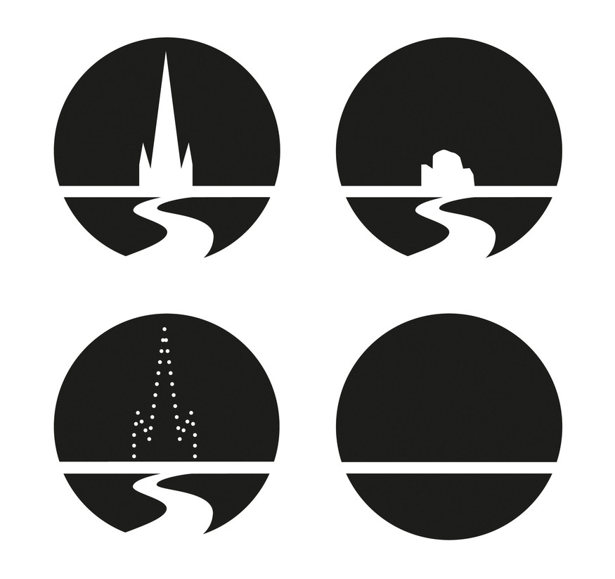
Matthew Galloway Suggested variations on the CCC logo. Courtesy of the artist
The tyranny of visual form
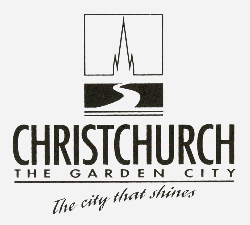
It was in the city’s Botanic Gardens that the Christchurch City Council logo was first launched in a special ceremony on 6 April 1990. The logo is made up of four descriptive elements: the blue skies represent the clear open air of the Canterbury Plains, the green land represents the lush spaces of the ‘Garden City’, the winding line represents the Ōtākaro Avon River, which in turn leads the eye up to the centerpiece – the iconic Christ Church Cathedral.
This descriptive logo was a graphic formalisation of an identity initiated from the very moment the Canterbury Association in London designated the swamplands of Canterbury for their new city; it also acted as a further subjugation of Ngāi Tahu, their relationship to place, and their narratives. The logo becomes a manifestation of power, a modality of governance.10
However, from 12.51pm on 22 February 2011, the Christchurch City Council logo could no longer be classified as descriptive. But on a much deeper level, the erasure of these built aspects (both the physical buildings and metaphysical brand) serve not only as a reflection on a new reality, but hints toward a return to a pre-colonised state; before Christchurch was imagined by European settlers; before stone cathedrals and intersecting roads erased the wetlands beneath them that had served as productive gathering grounds for Ngāi Tahu; sandy ground that came back with a vengeance, erasing the passage of time; the city’s sense of permanence and the colonising effect of the built environment.
As the dust settled on the central city post-quake, how was the exposed façade of identity in Ōtautahi Christchurch confronted? And what new possibilities for placemaking emerged?
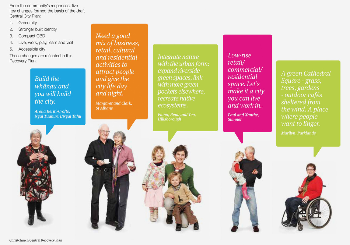
An example of the Share an Idea campaign visual
Share an idea – identity in post-quake Christchurch
By May 2011, with the Cathedral cordoned off and crumbling, and the Avon River polluted and winding its way in and out of the central city red zone, a severe dissonance existed between the way the city had been represented and the reality on the ground. In the direct aftermath of the rebuild, the narrative of Ōtautahi Christchurch was one defined by natural disaster and resilience. But, after the triage of early response, it became increasingly clear that a strong rebuild narrative was needed for the city to move toward a future not defined exclusively by what it had lost. On 5 May 2011, then Christchurch Mayor Bob Parker launched the Share an Idea campaign. A mass forum facilitated by the CCC, it consisted of post-it notes and comment boards filled with messages from the people of Christchurch concerning what they wanted their new city to be. The campaign – spearheaded by local marketing and design agency Strategy – was labelled as a success, attracting over 100,000 ideas. Sold as a crowdsourcing “creation process”,11 the visual language of the campaign combined bright colours and pictures of Christchurch residents revolving around a speech bubble motif that both illuminates and extends what could be seen as the true motivations of the campaign: to begin rebuilding a sense of place, and to promote a sense of democratised power.
Given this context, Share an Idea can be seen as a sort of covert rebrand, as opposed to a simple crowdsourcing campaign. As much as it was about pegging down the grand ideas of future cities flying around in the heads of its residents, this was an exercise in brand perception. Share an Idea was asking what Christchurch looks like post-earthquake, and answering the question at the same time: a place where the people are listened to, and where new cities are designed collectively by those who will live in them.
After the initial Share an Idea campaign roll out, the same imagery of real people alongside their ideas for a new Christchurch was employed throughout the CCC’s Draft Central City Plan, a bold document containing the beginnings of a vision for a new city. Crucially, this document reflected a willingness to give effect to the principles of the Treaty of Waitangi by integrating Māori principles into the planning. Ngāi Tahu identified key Tikanga Māori principles to be embedded in the Draft Central City Plan.12 Rangatiratanga (leadership and authority) was practiced through appropriate consultation and involvement of iwi (tribe) and hapū (clan). This led to a co-planning approach between the Crown, local authorities and Māori – including Ngāi Tahu setting up its own earthquake recovery committee, Matapopore.13 Kaitiakitanga (guardianship and stewardship) was another principle key to the recovery plan, with a strong link to sustainable resource management, but also acknowledging the place of tangata whenua in relation to the land and its ecologies.14 In this context, the Draft Central City Plan (CCP) specifically recognised the role iwi have in maintaining long-standing relationships with important places and species. In fact, the plan deeply integrated consideration of tangata whenua into intended outcomes, with a specific spatial layer included that identified sites of both contemporary and historic significance to Ngāi Tahu within the plan area.15 The plan specifically called for “opportunities to integrate the Ngāi Tahu narrative into the new city through planning and design of anchor projects and precincts.”16 In assessing both council and government level plans for the rebuild, Dr Rebecca Kiddle and Amiria Kiddle signal the chance to revisit an identity that was mostly colonial prior to the earthquakes.17 In this opportunity, they advocate for placemaking informed by Ngāi Tahu identity as contributing to “the creation of unique places given that these histories cannot be found elsewhere in the world.” When considering the post-quake response as a chance to renegotiate notions of place and identity, this level of consideration for tangata whenua exists in stark contrast to the deletion of any land for iwi inside the original maps of the city commissioned by the Canterbury Association in the 1850s. However, both in those early post-quake stages and now, as the political process of the rebuild in Christchurch has continued to unfold, it has become increasingly harder to identify which good intentions have turned into real change.
An early indicator of how plans might be complicated came later in 2011, when the Minister for Canterbury Earthquake Recovery, Gerry Brownlee, was granted unprecedented powers by the legislation that created his ministry; these included the right to “direct” and “specify … any changes to the draft recovery plan that he thinks fit.”18 With this legislation in hand, Brownlee worked to set aside much of the CCC plan and public consultation, directing a new central government unit to create an “implementation plan” in 100 days. Through this action, the democratic process and perception of power that Share an Idea promoted was undermined. Regardless of this shift in decision making, the visual language of Share an Idea continued to be employed and expanded. On the cover of Brownlee’s 100-day plan – named the Christchurch Central Recovery Plan (CCRP) – numerous multicoloured speech bubbles of different shapes and sizes overlap one another and are placed on top of the Avon River and central Christchurch streets, creating an abstract visual expression of the city regenerating through word of mouth. By co-opting the visual language of Share an Idea like this, Brownlee’s plan trades off the original campaign’s good will; branding the city as a place rebuilding through democratic process. At the launch of this second version of the plan, Minister Brownlee presented the vision for the rebuild with more green space allowed on the banks of the Avon river as it circles the central city, creating what he called a “city in a garden.”19
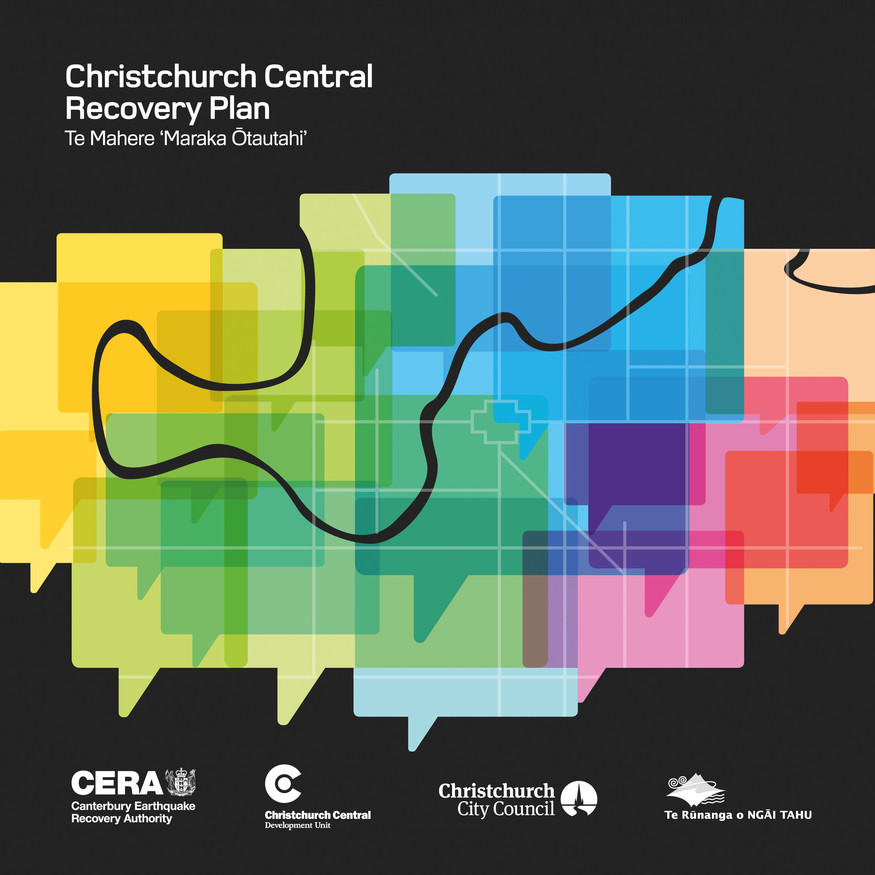
The cover image of Christchurch Central Recovery Plan
Nature over art
As a tool for governing, the visual practice of branding in Christchurch was able to formalise a well-cultivated brand first initiated by European coloniser settlers to the Canterbury plains in the mid-nineteenth century. As a result, the visual identity of the city – spearheaded by the Christchurch City Council logo – can be seen as an example of how design can uphold and forward harmful narratives, cementing imposed cultural viewpoints as the norm, and in the process subjugating others, in this case Ngāi Tahu. There is often a murkiness involved in how branding methods operate; this murkiness can be seen in post-earthquake responses to identity-making in the city. The Share an Idea campaign was able to exist in this space, seemingly inclusive in its intentions, while reaping questionable outcomes. Although an inclusive approach to the rebuild has been evidenced, with a strong voice given to local iwi, whether this results in a meaningful change to how Ōtautahi Christchurch rebuilds both its physical spaces, and its perception of place, remains a work in progress.
This article is an excerpt from a longer essay to be published in Federico Freschi, Farieda Nazier and Jane Venis (eds.), The Politics of Design: Privilege and Prejudice in Aotearoa New Zealand, Australia, Canada and South Africa (Otago Polytechnic Press, 2021). It is also an expansion on an article published in The Silver Bulletin in 2012.
Related
Exhibition
Things That Shape Us
24 July – 21 November 2021
Art, democracy and collective action in the aftermath of trauma.